BVRT – Benarkin to Linville 2021
Description:
A long walk? – Yes. A hard walk? – No! The walk is basically downhill along a section of the old Wulkuraka (Ipswich) to Yarraman railway line now known as the Brisbane Valley Rail Trail (BVRT). We’ll start our walk in Benarkin (an old timber town) and walk down the range to Linville. There are a few gullies to negotiate where the old railway bridges have been removed; a couple of these are quite steep but short. In a recent upgrade to the rail trail, the steepest were concreted, making the crossings easier and safer.
Benarkin has a general store and public toilets for your convenience before leaving. Free camping and showers are also available for anyone wishing to stay a night or two before or after the walk.
From here, the trail wends its way downhill, passing through Benarkin State forest where the tinkle of bellbirds fills the air. Moving into natural bushland, the trail crosses an historic culvert. A short detour leads to the bottom of the gully presenting an opportunity to walk through the large, century-old culverts installed to carry the huge volumes of water under the line in times of flood.
Continuing downhill, the trail emerges from the forest to allow great views of the Brisbane River Valley. At McNamara’s Camp, a shelter and chemical toilet provides a welcome break about halfway down. As the flora changes with a drier climate, stands of grass trees are prominent in the landscape.
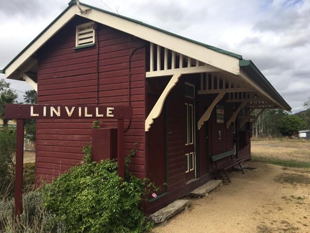
Linville is a small country town with a general store and hotel for refreshments. The old station has information boards as well as several original items of railway rolling stock for inspection. Again, it has free camping for those wishing to stay before or after the walk as well as showers at the hotel for a small fee.
This activity will be conducted in keeping with health department Covid-19 directions regarding social distancing, good hygiene practices and group size in force for the venue/area at the time of the activity
Please do not attend this activity if you are feeling unwell on the day, or may have had contact with covid-19 in the 14 days prior to the activity.
Please register for this activity via the NPAQ website completing all fields.
Walk Grading: Blue (Intermediate) 18 km mainly downhill including some steep gully crossings – a moderate level of fitness required.
Meet: At the Railway Station in Linville at 7.30am for a car shuttle to Benarkin.
What to Bring: Hat, light jacket, rain gear (just in case), torch, whistle, 2+ litres of water, morning tea, lunch, afternoon tea, positive outlook, $5.00 NPAQ Fee
Directions: From Brisbane, travel north along the Bruce Highway, turning onto the D’Aguilar Highway at Caboolture. Travel through Woodford and Kilcoy, across the Brisbane River to Moore. Turn right at Moore to Linville. Allow 2-2 ½ hours
Those living on the Southside might find it easier and shorter to travel along the Ipswich Motorway, turning onto the Warrego Highway towards Toowoomba. After passing through Blacksoil, turn right onto the Brisbane Valley Highway. Travel trough Esk, Toogoolawah and Harlin. About 4km north of Harlin, turn left onto the D’Aguilar Highway towards Moore. Turn right at Moore to Linville. Allow 2-2 ½ hours. Carpooling is encouraged.
Nominations: NPAQ Website
Leader: For more information contact the leader, Frank Freeman (Ph07 3824 3954; Mobile: 0427 655 514 Email: frank_fr@bigpond.net.au)
NPAQ Activity Report
BVRT – Benarkin to Linville 2021
Date: Sunday, 16 May, 2021 Leader: Frank Freeman
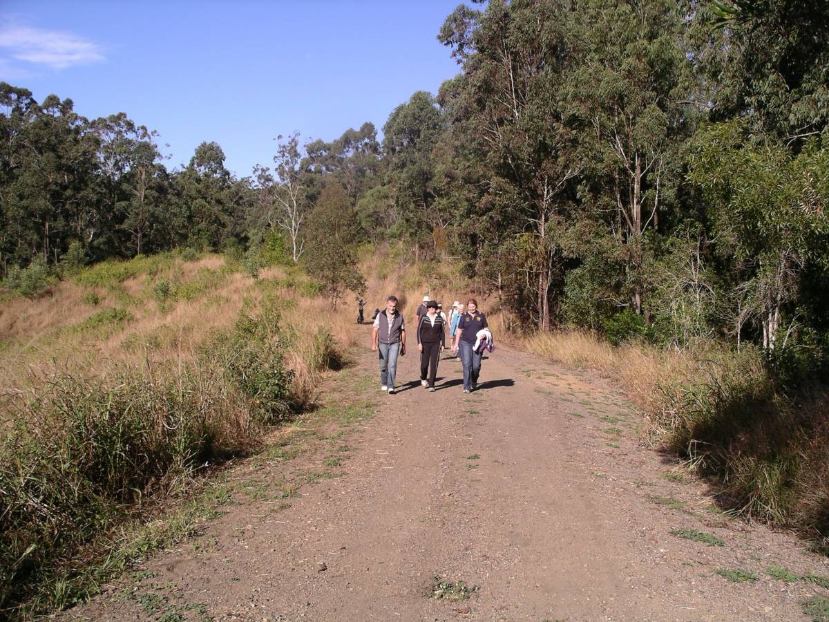
Meeting at Linville at 7.30am, 11 walkers signed-on and got into cars for the drive to the start of the walk in Benarkin. After a short briefing, the group began the 18km trek down the range along the disused Brisbane Valley Railway Line.
It was not long before the tinkling chime of bellbirds permeated the area as the walkers passed through the first of several colonies of these pretty, but shy, birds. It was here, also, that, while they were walking in the natural forest of the area, the man-created pine forest was just metres on the right.
The size of the century-old culvert indicated that huge volumes of water needed to be allowed to flow beneath the embankment to ensure the line above remained safe in the face of potentially devastating floods. It was also time to enjoy morning tea at the picnic tables at the Fettlers’ Rest memorial while reflecting on the hardships of the men and women who built and maintained the line over the decades.
After safely negotiating several step gullies, (necessary because the decaying bridges had been removed to ensure the safety of passers-by), a comfort stop was had at McNamara’s Camp, the only toilet along this section of trail.
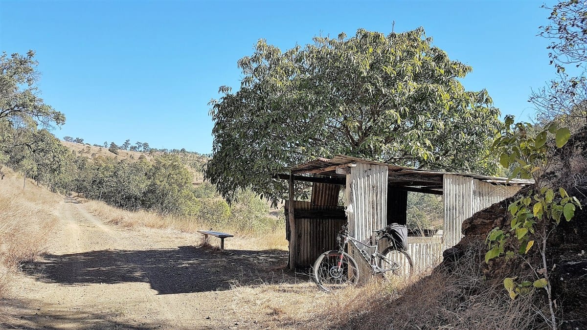
As for most of this section of rail-trail, the walk continued downwards to the Machine Hut, a place where fettlers once stored their tools but now a rest stop for users of the rail trail. Here the group enjoyed lunch as well the magnificent views both up and down the valley.
Grass Trees dominated the next section of the trail with stands of these ancient plants on both sides of the track. There were also several stands of the trees on the side of the opposite hill, although not as prominent as remembered possibly because of the increased foliage grown by a good wet-season in the area.
Soon the track levelled out and the walkers entered Linville to reflect upon the adventure over a good cup of coffee and country hospitality in th