Indigenous Conservation, National Parks, Private Reserves, State Forests
Wetland Rewind: Learning from the Past at Sanamere Lagoon, Cape York Peninsula
Studying past environments (palaeoenvironments) gives us a better understanding of how currently protected areas have (or haven’t) changed over thousands of years. Natural archives, such as lakes, capture this environmental information; sediments incorporating microfossils such as pollen, charcoal and other plant matter blown or washed into the water slowly build up and are preserved in layers at the bottom of the lake. Palaeoenvironmental sciences provide insights into interactions between fire, climate, humans and vegetation over timescales beyond the observational record, which in Australia covers approximately the last century.
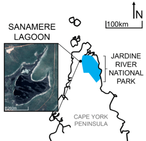
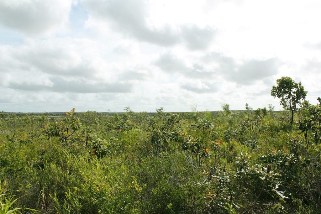
Sanamere Lagoon located alongside the Jardine River National Park is one such natural archive, recording over 32 thousand years of environmental conditions. The site is within the Jardine River wetlands, part of the lands of the Angkamuthi people (AIATSIS 2020). Sanamere Lagoon today is a large, shallow lake fringed by sedges that also extend in shallow bands across the lagoon. The water and sedges are surrounded by dwarf heathland, a vegetation type containing numerous endemic plants (e.g. Nepenthes pitcher plants, Grevillea, and Banksia) and threatened by inappropriate fire regimes (Keith et al. 2014, p.288). Appropriate use of fire for biodiversity conservation is a key management issue for this environment (Department of the Environment & Energy 2017).
Wetland Rewind
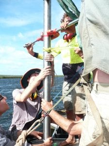
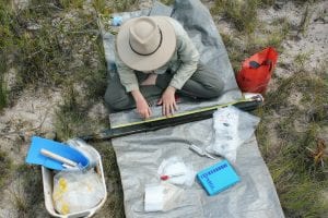
Sanamere Lagoon formed approximately 32 thousand years ago. At this time, Papua New Guinea and Tasmania were still connected to the Australian mainland (Reeves et al. 2013) creating one large land mass. Our team, led by Professor Michael Bird of James Cook University and the ARC Centre of Excellence for Australian Biodiversity and Heritage (https://epicaustralia.org.au), sampled this natural archive and reconstructed its environmental history.
Sanamere Lagoon has been permanently wet since it formed. None of the sediments in the two metres collected from the centre of the site show drying or erosion damage. An increase in rainfall occurred at the site around 14 thousand years ago, suggesting the activation of modern monsoon conditions consistent with the findings of other studies in northern and western Australia (see Reeves et al. 2013, p.102, 105).
The dwarf heathland vegetation around the lagoon today became more dominant around eight thousand years ago. Before this period, sedges were the main vegetation type around the site. Sanamere Lagoon itself likely expanded and deepened at this time, with less sediment reaching the middle of the lake. This occurred at lakes across Cape York Peninsula as conditions became increasingly wet throughout the region (Luly et al. 2006). The land bridge between Cape York Peninsula and Papua New Guinea was also flooded by rising sea levels around this time (Reeves et al. 2013).
Charcoal throughout the record shows the persistent presence of fire in the dwarf heathland ecosystem, often at high intensities. Burned sedges also appear throughout the record, demonstrating that conditions were periodically dry enough for these usually waterlogged plant types to burn. Very fine particles of burned grass also hint at fires in the grassy open woodland beyond the heathland, burning at different times to fires within the heathland around the lake. The ignition source of these fires is difficult to determine, but may reflect both human- and climate-driven fires, and likely includes some degree of Indigenous fire management.
Approximately four thousand years of sediments are missing from the most recent part of the record, with a sudden jump in the archive to around 170 years ago. These lost sediments were probably pushed to the edges of the lagoon or swept into the nearby Jardine River by one or more severe storm events, such as tropical cyclones. The last of these storm events to affect Sanamere Lagoon occurred over 170 years ago, as sediments have resumed accumulating since that time.
Learning from the Past
The water permanency of Sanamere Lagoon and persistence of heathland vegetation over thousands of years indicates stability of the site and associated ecosystems. This includes during previous phases of both higher and lower rainfall, and overall long term monsoonal climate transitions. However, careful management is required to maintain stability, to conserve wetlands and heathlands into the future and to protect these environments from threats caused directly and indirectly by humans. These threats include land clearance, changing fire regimes, invasive plants and climate change (Keith et al. 2014, p. 298-304).
The long term occurrence of high intensity fires in the Sanamere Lagoon heathland tells us that hot fires are a key component of this environmental system; this is supported by modern studies demonstrating that heathland plants require infrequent, hot fires for regeneration (Crowley 1995, p. 18; Keith et al. 2014, p. 299)/ Fire also plays an important role in nutrient cycling in these characteristically low nutrient environments (Crowley 1995, p. 8; Keith et al. 2014). Maintaining a regime of hot fires at intermediate to long intervals is critical to conserving the heathlands of Cape York Peninsula, and more research is required in heathland environments to determine ideal fire return intervals and patchiness to achieve the best biodiversity outcomes (Keith et al. 2014, p. 305).
Sanamere Lagoon stores 32 thousand years of environmental history of the wetlands and unique heathlands of Cape York Peninsula. Deliberate management, including of fire regimes, is required to avoid the disappearance of heathlands, as these landscapes can be susceptible to invasion by exotic weeds and degradation by other demands of land use (see Keith et al. 2014, p 298-304).
Sanamere Lagoon gives us a glimpse into the extensive environmental history of our important wetlands. To understand and conserve these environments long-term we need to expand our awareness to include a deep time perspective, learning from the past to create a stronger future.
References
Australian Institute of Aboriginal and Torres Strait Islander Studies [AIATSIS] 2020, AUSTLANG – Y7: Angkamuthi, viewed 5 February 2020, <https://collection.aiatsis.gov.au/austlang/language/y7>.
Crowley, GM 1995, Fire on Cape York Peninsula, Cape York Peninsula Land Use Strategy Program, Office of the Coordinator General of Queensland, Brisbane, and Department of the Environment, Sport and Territories, Canberra.
Department of the Environment and Energy 2017, NVIS Fact Sheet MVG 18 – Heathlands, Commonwealth of Australia, viewed 5 February 2020, <https://www.environment.gov.au/ system/files/resources/2edcda80-d9b749d4-9e97-36236b91e9f9/files/mvg18-nvisheathlands.pdf>.
Google Earth 2020, Sanamere Lagoon, Cape York Peninsula, Queensland, 11°07’19”S, 142°21’32”E elevation 16m, viewed 10 February 2020, <https://www.google.com/earth/index.html>.
Keith, D et al. 2014, ‘Heathlands’, in D. Lindenmayer et al. (eds), Biodiversity and Environmental Change: Monitoring, Challenges and Direction, CSIRO Publishing, Victoria.
Luly, JG, Grindrod, JF & Penny, D 2006, ‘Holocene palaeoenvironments and change at Three-Quarter Mile Lake, Silver Plains Station, Cape York Peninsula, Australia’, The Holocene, vol. 16, no. 8, pp. 1085-1094.
Pearson, S et al. 2015, ‘Increasing the understanding and use of natural archives of ecosystem services, resilience and thresholds to improve policy, science and practice’, The Holocene, vol. 25, no. 2, pp. 366-378.
Reeves, JM et a. 2013, ‘Palaeoenvironmental change in tropical Australasia over the last 30,000 years – A synthesis by the OZ-INTIMATE group’, Quaternary Science Reviews, vol. 74, pp. 97-114.
