National Parks
D’Aguilar National Park
D’Aguilar National Park, the park on Brisbane’s doorstep, lies northwest of Brisbane city. The section along the southern end of the D’Aguilar Range was formerly known as Brisbane Forest Park. A nature based recreation area, it was formed in 1977 after several small national parks, scenic reserves, some state forests, water catchment areas, and parcels of freehold land were amalgamated.
It is the largest and most accessible reserve of its type so close to a major city, anywhere in the world. At approximately 36,000 hectares it’s the second largest park in south-east Queensland, only surpassed by the Cooloola section of Great Sandy National Park.
History
Timber-cutters came to the Samford Valley and Mount Mee areas around 1870 and soon expanded to more areas on the D’Aguilar Range in search of prized red cedars, hoop pines and other quality timbers. Evidence of early logging can be seen by many stumps throughout the park and the notches cut into them where the springboard platforms were placed. There’s also ever present evidence of the forest’s ability to renew itself.
Gold fever gripped the new colony of Queensland in the mid-1800s. Although it was doubted that gold deposits existed in the volcanic soil and rocks of the D’Aguilar Range and Mount Coot-tha areas, optimistic miners began small scale mining from around the 1880s and continued to the early 1950s.
Sporadic mining over seventy years yielded very poor results of low quality ore and in 1959 the lease for the last active mine, which was located at Mount Coot-tha was surrendered, for non-payment of rent. Relics of this mine, the Ghost Hole Mine, remain in that section of the park.
As the 19th century turned, the Forestry Department began establishing reserves for a sustainable timber industry and for public use. In 1903, land on Mount Glorious became available for public purchase. Some areas were cleared for farming; others were subdivided for housing.
D’Aguilar National Park was originally six separate areas totalling 3270 hectares. Four were gazetted as individual national parks following submissions from the local progress association, forestry officials and well-known conservationists like Romeo Lahey. Two other environmental parks made up the national park. They were on undeveloped lands with limited public access, west of Mounts Nebo and Glorious.
Jollys Lookout National Park, proclaimed in 1938, was the first of the D’Aguilar national parks. From the lookout there are great views of the D’Aguilar Range, down into the Samford Valley and all the way to Moreton Bay’s northern islands. Interpretive signs at the lookout highlight the importance of the range in capturing clean water for southeast Queensland.
Maiala National Park followed in 1940. Sections had been set aside for ‘public enjoyment’ since 1901, including Love Creek in 1930. Maiala’s picnic area was previously cleared and used for cattle grazing. Later, hoop pines were planted and a steam-powered sawmill was built in 1918 to process timber from the rainforests. Brown pine and quondong timber was in demand for the boat-building and plywood industries. The mill was eventually abandoned and the land forfeited to the Crown.
The first walking track in Maiala National Park was started in 1946 following the Second World War when the state’s economy was low and unemployed men were used to construct tracks. To instill a sense of national pride, people were encouraged to get out and enjoy their natural environments. Walking was also a cheap recreational activity in those poorer times. Track extensions to Cypress Grove and Greene’s Falls were completed in 1947 and in 1965 Queensland’s first self-guided nature trail along the Rainforest Circuit was opened.
Boombana and Manorina National Parks were proclaimed in 1948.
In 2006, sizeable parcels of state forest land were transferred to the national park estate creating a 60 kilometre long unbroken chain of protected land, linking the smaller, isolated national parks. D’Aguilar National Park forms the largest protected area on the edge of any capital city in the world.
Environment
D’Aguilar Range forms a connection between the Border Ranges to the south, the Conondale Range to the north, and Bunya Mountains to the west. It’s the result of relatively recent volcanic activity. Some water from the catchment area flows into Wivenhoe Dam that supplies parts of Brisbane.
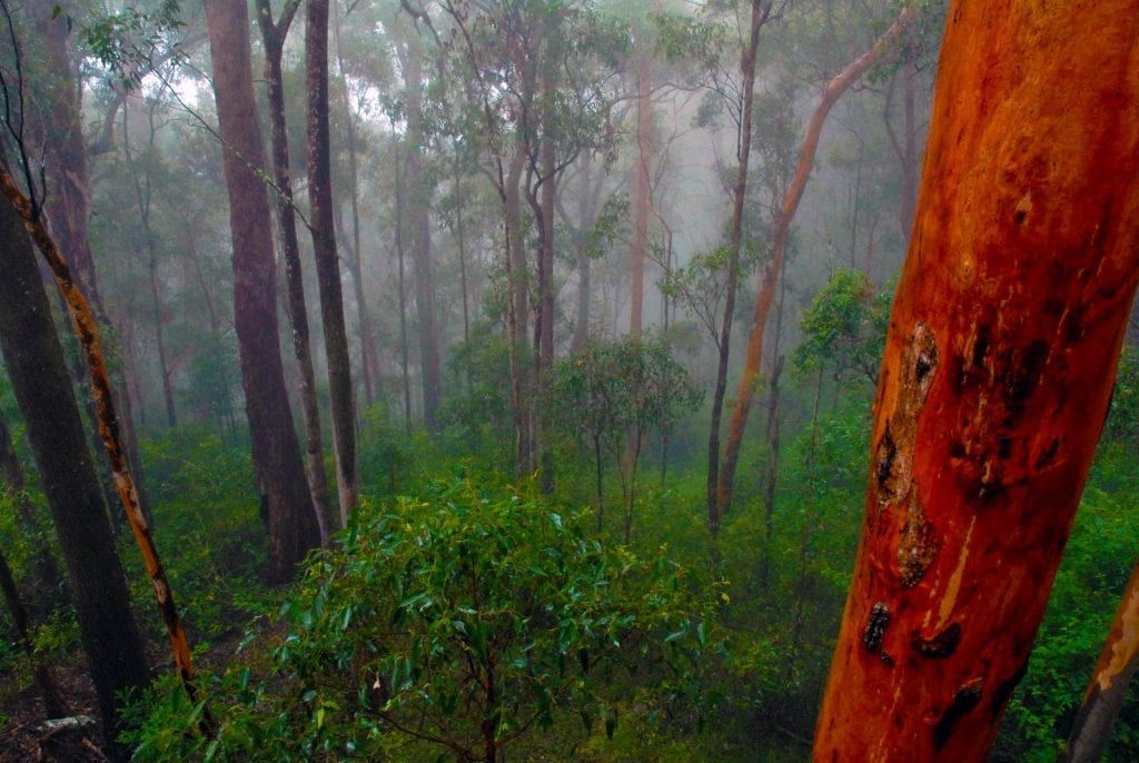
Open eucalypt forests cover about 90 per cent of the park. About 20 different species have been identified. Blackbutts, Sydney blue gums, red and pink bloodwoods, grey gums, broad-leaved red ironbarks, tallowwoods and brush box are some examples. The remainder of the park is made up of rainforests, closed forests and grassed clearings.
Subtropical rainforests grow in patches from Mackay in Queensland, to northern New South Wales. On the D’Aguilar Range, they tend to grow on the southern slopes in areas that have resisted fires. Maiala, Manorina and Boombana sections protect examples of quickly disappearing subtropical, closed-canopy rainforest ecosystems and are the closest rainforest parks to Brisbane. They provide habitat for rare and vulnerable animal and plant species. Some brush box in the rainforests, and tallowwood that grow along the margins, reach 50 metres high and tower above the canopy. Understorey plants have adapted to the darker, moister conditions below the canopy. There’s an almost pure stand of weeping myrtle along the creek in the Manorina section, as well as the only stand of cabbage tree palms on the range. Small-leaved figs and groves of piccabeen palms also feature throughout the rainforests. During summer, yellow flowering wattles and red lilly pilly fruit are evident along the tracks.
The diverse habitats of the forest provide sanctuary for many different animals and birds. Colourful finches, parrots and honeyeaters flit among the trees. Noisy pittas, regent bowerbirds and paradise riflebirds are usually seen closer to the ground. Brush-turkeys, a seemingly permanent inhabitant of Queensland’s rainforests, are regular visitors to the tracks and picnic areas.
Most of the park’s animals are nocturnal and koalas, echidnas, brushtail possums, tiny Queensland blossom bats, marsupial mice, and dingoes are the most common residents of the forests. Lizards, frogs, snakes, butterflies and beetles are also plentiful. Over 900 insect species have been recorded from just one of the subtropical rainforest tree species.
The Critically Endangered Mount Glorious spiny crayfish (Euastacus setosus) are endemic and only live in one creek system that’s protected in Maiala. They only survive in running, unpolluted water with temperatures below 20°C. Growing up to 12 centimetres long, this orangey-brown crayfish is distinguished from other freshwater crayfish by the short, soft spines on their abdomen and nippers. At night they emerge from their burrows along the creek bank to feed on fruit and rotting vegetation that has fallen to the forest floor.
The Southern Day Frog (Taudactylus diurnus) once inhabited fast-flowing waterways and fed on insect larvae in the rainforest areas of Mt Glorious, Mt Nebo and the Blackall and Conondale Ranges. When disturbed the tiny 30mm frogs were able to dive into swift torrents and cling beneath rocks until danger had passed. While most frogs are nocturnal, these little creatures were mostly active during the day. They have not been sighted in the wild since 1979 and after years of searching were listed as extinct in 2002.
Sourced from: Take a Walk in South-East Queensland by John and Lyn Daly


