Uncategorized
Expansion of the Protected Area Estate on the Granite Belt
Jul
The Granite Belt region of Southern Queensland is well known for its significant national parks and as a thriving ecotourism destination.
The region has a high degree of habitat diversity due to its elevation, topographic variation, outcropping rock and a pronounced east-west rainfall gradient. Vegetation includes tall open forest and woodland on rocky slopes, grassy open forests and woodlands on the deeper soils of lower slopes and alluvial plains and shrub lands on rock pavements. 45% remains as remnant vegetation and is a distinctive feature across the landscape.
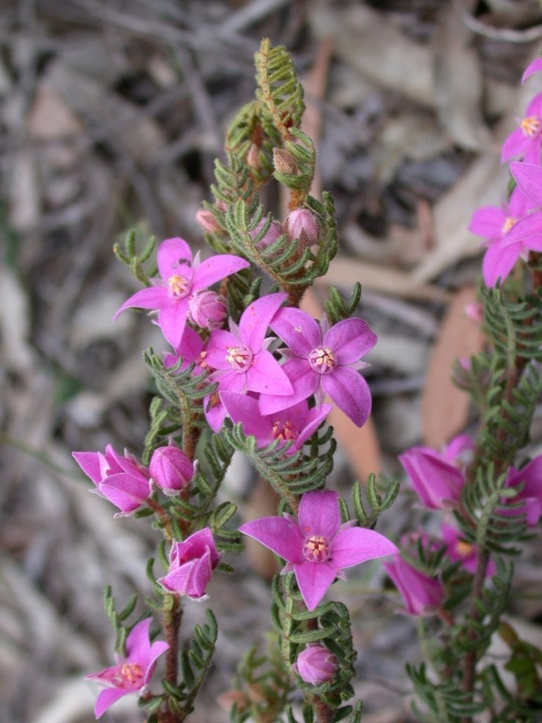
Over 900 species of flowering plants occur in the region with 20 listed as threatened, including 5 recently classified as critically endangered. There is also a wonderful diversity of fauna species and the region is a stronghold of the spotted tailed quoll.
Girraween National Park and Sundown National Park together cover more than 24,450ha and protect many of the region’s biodiversity values as well as its outstanding landscape features. They also are major tourism draw-cards for visitors to the region.
To complement these attractions, increase the protected area estate and protect some of the unrepresented biodiversity values, a coalition of interests in Southern Queensland, led by the Granite Belt Sustainable Action Network, have recently combined with the NPAQ to lobby for an expanded parks system.
The groups have identified two existing State Forests and one major unprotected area where opportunities exist to provide for better protection and management which will not only ensure their biodiversity values are protected and enhanced, but will add to the region’s ecotourism attractions and ease pressure on the existing national parks.
The 915 ha Broadwater State Forest, just west of Stanthorpe, has high conservation and scenic values and is also very accessible for a range of nature-based recreational activities. It contains four regional ecosystems, three of which are classified as “endangered,” and is little affected by past human activity. This generally open eucalypt forest was heavily impacted by a major bushfire in September 2019 but is recovering well after good rainfall in the last couple of years. Of particular interest, it is likely to contain the best remaining populations of the endangered Boronia repanda which fortunately appears to be resprouting after the bushfire as well as seeds germinating.
There appear to be no major impediments from competing uses to a conversion of this state forest to a higher level of conservation protection such as conservation and national park. Existing uses include bushwalking, mountain bike and horse riding, bouldering and orienteering and additional resources would need to be made available to the Queensland Parks and Wildlife Service (QPWS) to ensure that its conservation values are protected and recreational uses adequately managed.
A further 15 km west, the extensive Passchendaele State Forest also contains areas of significant conservation value. Although the majority of this forest was cleared for soldier settlement farms after World War 1 and then planted to exotic pine plantation in the 1950s, it has retained some areas in a relatively pristine condition. The most southerly part of the forest at Amiens covers approximately 600 ha of eucalypt forest and heathlands amongst rock pavements and rugged granite boulders. This is an area of high conservation values and supports a range of threatened flora and fauna including the endangered Boronia granitica, Bertya recurvata and Zieria graniticola as well as spotted tailed quolls, glossy-black cockatoos, powerful owls, and border thick tailed geckoes.
Further survey work by Birdlife SQ is currently underway to better determine what fauna species may occur here and contribute to the business case for protecting these areas. Quite apart from its biodiversity significance, the elevated areas of this forest have great scenic value with views south-east to Girraween and south-west to Sundown. The area does not have an extensive track system and current recreational use is mainly for bushwalking, orienteering, bouldering and limited mountain bike riding. Conversion to national park status would have to be accompanied by additional resources to the QPWS to ensure appropriate management can occur.
The other potential area for conservation on the Granite Belt is the extensive Roberts Range which links Sundown National Park to Girraween. Travelling south from Stanthorpe on the New England Highway, this range is the major feature on the landscape west of the highway, providing a very scenic backdrop to the horticultural areas at Ballandean.
There has been a long- standing national park proposal for this range as it would provide a wonderful opportunity to link these two major national parks, securing a biodiversity corridor and the potential for a long-distance walking trail and other ecotourism possibilities.
The properties making up the Roberts Range are all in private ownership but its rugged and densely forested nature has meant it has little productive use for grazing or agriculture. It contains around 8,050 ha of remnant vegetation comprising eight regional ecosystems, five of which are considered ‘endangered’. The Biodiversity Planning Assessment for the New England Tablelands Bioregion which was undertaken by the former Environmental Protection Agency (now the Department of Environment and Science) in 2006 highlighted the significance of the Roberts Range as a corridor of state conservation significance.
Transitioning these areas to conservation protection such as national park (subject to landowner), special wildlife reserve (effectively a private national park), or nature refuge could allow for a regional approach to managing weeds, pests, fire and potentially open up ecotourism opportunities. Such transition would require funding for opt-in acquisition as well as resources to the QPWS/the region for coordinating improved management. With an expanded parks system that is better managed, perhaps the Granite Belt could compete with Tasmania’s Three Capes Walk and Blue Derby Mountain Bike Trails.
These conservation projects will take some time to achieve but there is broad support in the local community particularly from key players such as the Southern Downs Regional Council and the Granite Belt Wine and Tourism so this will assist in achieving a positive outcome.